Panther-Passing-Across-The-Sky

I love a good meteor shower.  And I once stayed up with the kids to watch the Russian Mir fly over.  Pretty cool.  I missed Friday night’s sky show here, but it put me in mind of a story which circles around to broken potsherds.  Well, I guess all sherds are from broken pots, and Forrest has a slew of them in his backyard and at San Lazaro.

According to Alan Eckert in The Frontiersman, the night Tecumseh was born, March 9, 1768, a brilliant meteor flashed across the sky.   This shooting star was, according to the old tales, The Panther, a great spirit passing over seeking a home in the south and it was a good sign.  The Shawnee newborn was, therefore, named Tecumseh,  The-Panther-Passing-Across.

English: Possibly a painting of Tecumseh, the ...

English: Possibly a painting of Tecumseh, the Shawnee Indian who tried to unite all Native Americans to defend themselves from the growing Unites States of America. (Photo credit: Wikipedia 


Tecumseh’s brother was called the Prophet, but according to the author, Tecumseh himself foretold the coming New Madrid earthquake several years before the event.  In addition, another great meteor blazing across the sky  would be a sign for the tribes to begin the countdown to the earthquake, which was itself the sign for them to gather as one to defend their land against the Americans.

Tecumseh had given each tribe a slab of red cedar with symbols on it and a bundle of red sticks.   Each month they were to toss one stick away.  When there was one stick left, they were to watch for the sign.

Just before midnight on November 16, 1811, the flash of light came out of the southwest and crossed to the northeast.   The chiefs were to cut the last stick into thirty pieces when they saw the meteor.

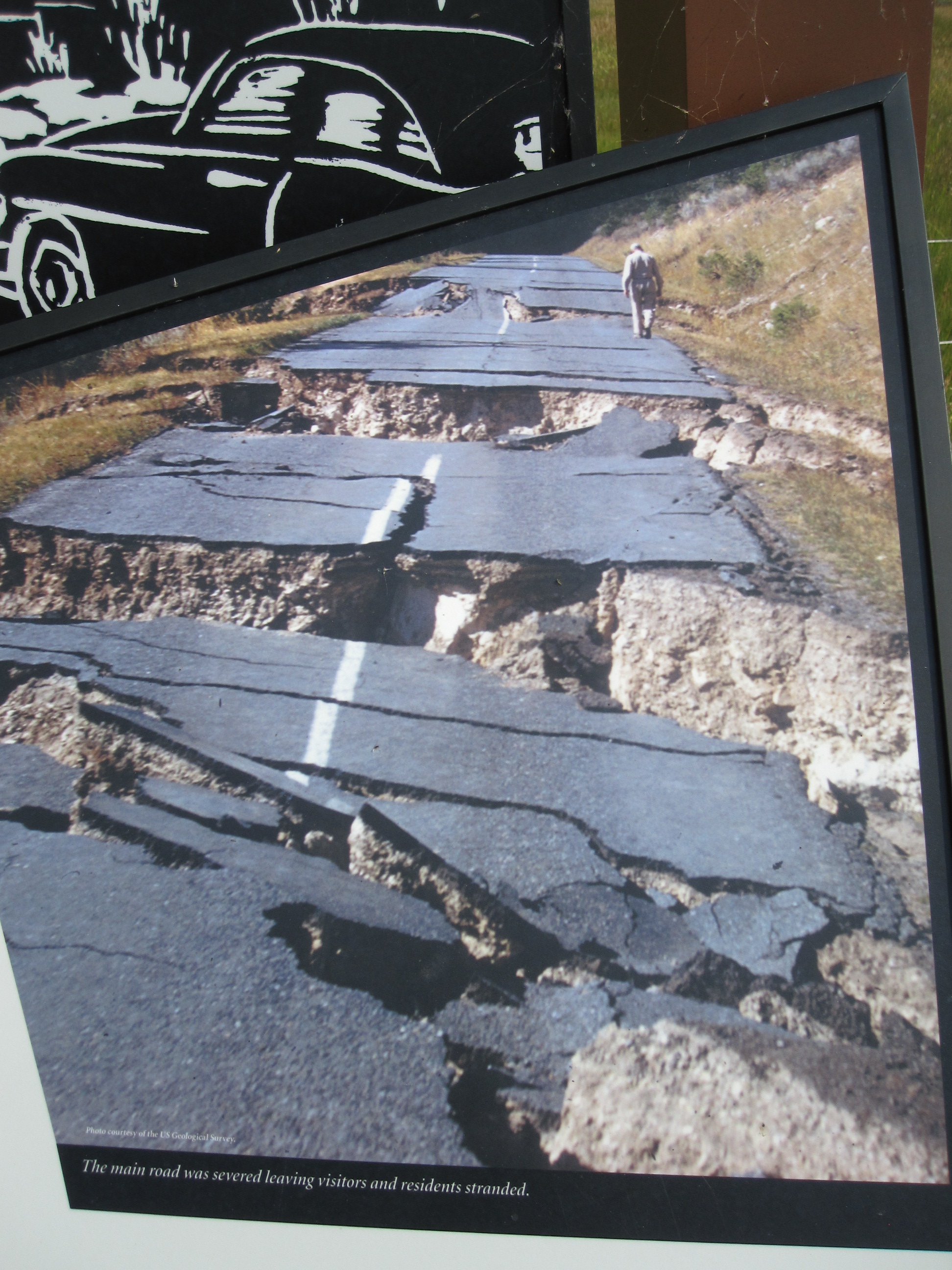
At 2:30 am on December 16, 1811, the earth shook, from the south of Canada where the Great Lakes sloshed,  to the western plains where bison stampeded and earthen vessels shattered.  And those tribes that kept their pledge headed for Detroit.

An observer in Louisville recorded 1,874 separate quakes between December and March.  The diary of George Crist is compelling reading:

16 December 1811 —“It was still dark and you could not see nothng.  I thought the shaking and the loud roaring would never stop…..I don’t know how we lived through it….”

23 January  1811 —“What are we gonna do?  You cannot fight it cause you do not know how….We lost our Amandy Jane in this one…. A lot of people think the devil has come here…..”

8 February 1812  —  “If we do not get away from here the ground is going to eat us alive….”

20 March 1812  —  “We still have not found enough animals to pull the wagons and you can not find any to buy or trade.”

14 April 1813  —  “We lived to make it to Pigeon Roost…..From December to April no man…would dare to believe what we lived through.”

Another great eyewitness account was written in March 1816 and published in 1849:  Lorenzo Dow’s Journal.

Can you say, “Teremoto“?

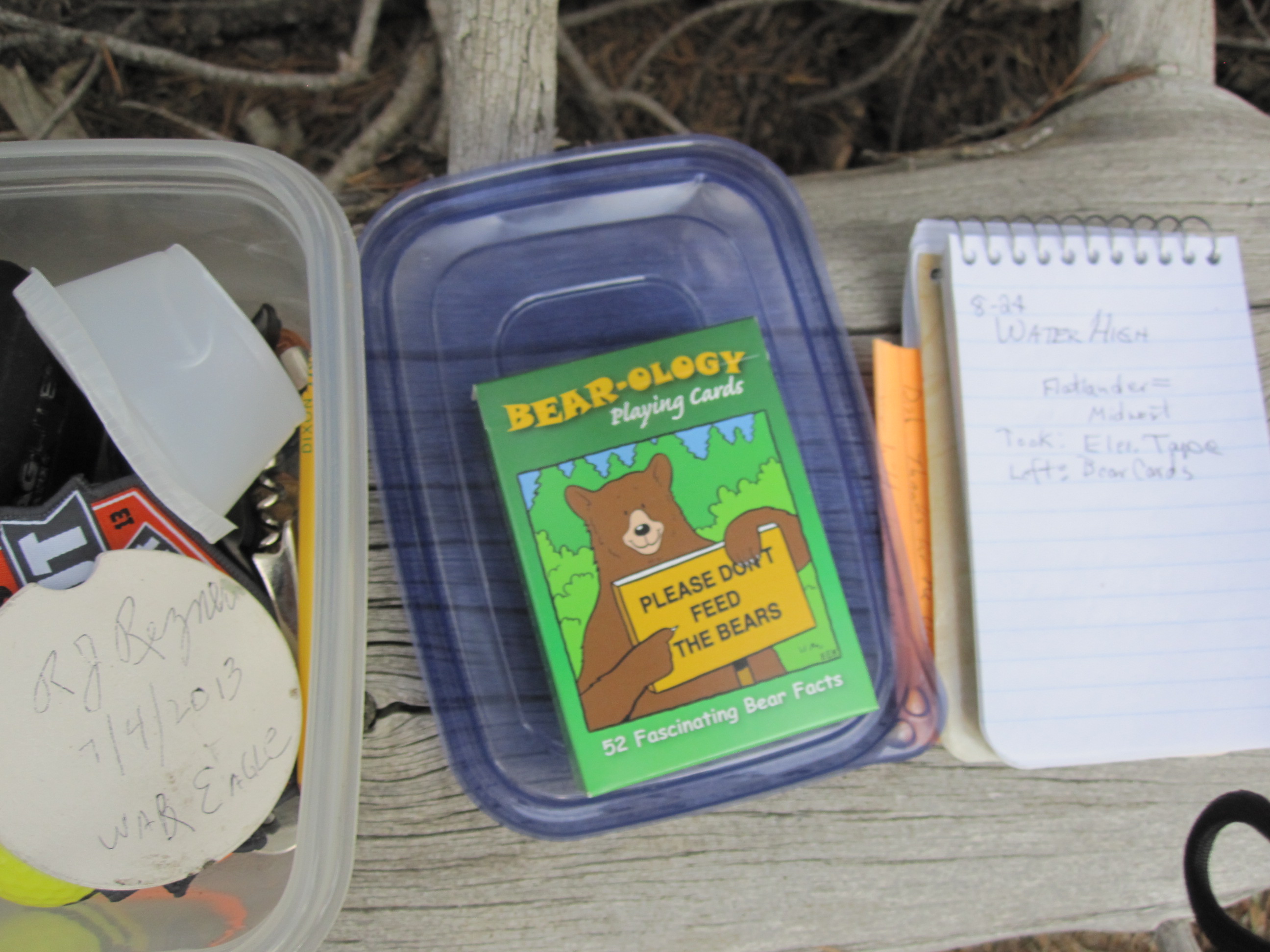
But, back to the pottery.  I’ve been digging deep in the chapter of Too Far To Walk, the one where Charmay and Forrest are doing archaeology at San Lazaro.   Not to put too fine a point on it, I was going to email Forrest about another rabbit trail I was on.

Now, I’ve always been a bit cryptic about my ideas, even when emailing him.  Not that I didn’t trust him.   I do.    I just figured  some 12-year-old whiz kids could tap into people’s communications, if they so chose.  Have I been cryptic enough?   Too cryptic.  Hmmm.

So.

Sorry.

You read all this way and it’s a dead end.  No clues for you.

No.  Really.  Sorry.

Fade to music:  Gordon Lightfoot singing “If You Could Read My Mind, Love, What A Tale My Thoughts Would Tell…..”

From Forrest Fenn’s Collection See more at Old Santa Fe Trading Co dot com

Or, Kermit, the Frog, singing “The Rainbow Connection”

Related articles


Enhanced by Zemanta

West Yellowstone & Up the Gallatin (Part IV)

IMG_0341

In the morning, the first item on my agenda was to find Dal’s cache in the woods.  His GPS coordinates were of no use to me, but fortunately his instructions were clear, and if precisely followed would lead me to the stash with confidence.  It also didn’t hurt that I’d seen the photos on his blog.  IMG_0336

I’d brought a set of ‘important bear info’ playing cards to leave in the tub.  To make room, I had to choose between a black thing and electric tape.  I took the tape.  IMG_0338Good to go.

The rest of the morning was spent driving down the Madison and checking out the earthquake damage.  I’d been there the day it happened and again when I was ten.  (See Terremoto entry.)IMG_0366

IMG_0447

The Hebgen Lake Dam and fishing access was closed for construction/repairs.

Possibility of water high?!

Possibility of water high?!

Surprising how the rocky scars still look fresh.  In fact, across from the Earthquake Visitor’s Center (also CLOSED), I saw an omega blaze and looked quickly down.

OMG!  The Omega?

OMG! The Omega?

Okay, between me and the hidden treasure chest was a rushing river, boulders, and a steep ravine.  Hmm.  I’ll come up from below, I thought.  IMG_0431I drove down to where the valley opened up.  A longer hike than I’d be doing alone in the heat.  Maybe not ever.

I turned around and drove back up the ‘hill’.   Now, there were  2 empty cars parked along the road.  For a moment I panicked and thought they were just ahead of me on the chase.  I parked and started hiking down the slippery slope across from my blaze.  And then I saw them.

It turned out, they were ‘just’ fishing.

IMG_0454I had some time to think there on the slide.  The more I gazed across the river, the more I realized that spot was just not possible to reach safely.  Not for a child, a person of eighty, or even one approaching 60.  Anyone in between, go for it.  You have my blessing.  Go in peace.

Instead of heading north, I went back into West Yellowstone for bear spray, just in case I got brave enough to get in the wood.  And, just to remind myself of the vertical factor this winter while I’m poring over maps, I picked up a 3-D molded plastic version map of the area.  I think we still have a Denver/Rockies one from 28 years ago.
I inquired of the volunteers at tourist info as to where Watkins Creek was.  In addition to printing me a map,  they mentioned  a $6k per week Firehole.  I started out for it, but the tarred road was scant. IMG_0473 I made it a bit past the nice boat launch/campground before I was jarred into turning around. Clearly the movie stars they’d mentioned must fly in.IMG_0474
I only had 6.7 more miles of gravelly washboard to go.  If Mr. W gets that pickup, we’ll try it next year.  Plus, that will give me an extra year to get into shape to reach those aptly (?) named lakes above there. *** Is there an air ambulance available for the over-confident? she wonders.

After lunch, I headed up Highway 191, the Gallatin River valley, to the Soldier’s Chapel.  I’d recently read The Bloody Bozeman, and have to agree with the person who mentioned that Bozeman ought to be named Story.  Bozeman was rather reckless with other people’s lives.

IMG_0485
I headed south to where I’d made a reservation for the night.  A welcome thunderstorm passed through that night and drenched the area.  Helpful to those battling a fire or two.  IMG_0345 I planned to attend the chapel service Sunday morning, and then, if I was really brave, I just might have (probably not), ridden the ski lift/tram up Lone Mountain before heading to parts north.
But, there was an email waiting for me.  From Forrest Fenn.
***  If I had kept up with Dal’s blog the day I was packing, I would have realized that a couple of fearless, and healthy, searchers had made the trek up the mountain to not just Lower Coffin Lake, but the Upper one as well.  So, maybe we don’t need that pick-up truck. . . .

Terremoto

English: USGS map of Yellowstone Caldera showi...

English: USGS map of Yellowstone Caldera showing earthquake locations. (Photo credit: Wikipedia)

The first earthquake I experienced was the Yellowstone event in August of 1959.  Maybe I was 5.  All I remember really is seeing my mother upset in the middle of the night.  We had passed through Yellowstone that day and were in a motel room just west of there.  She thought a semi had rumbled off the road just outside but couldn’t see anything.

Morning Glory poolWe returned to Yellowstone when I was ten, camping in our brand new Nimrod tent trailer.  I do remember that trip, especially the bears banging the trash cans outside in the dark.  We climbed our first mountain, Mt. Washburn.  Gazed in marvel at

Morning Glory pool. I took some shaky black and white photos with a small square camera.

The Mountain That Fell

The Mountain That Fell

The devastation from the earthquake was apparent.  A highway disappeared into a lake.  A house/cabin sat half-submerged.  Giant boulders rested across the valley from the mountains where they rolled down from.  Huge.

Rolled down the mountain, across the valley and up the other side

Rolled down the mountain, across the valley and up the other side

In time, I made sure our kids saw the park, too.  Our youngest was ten. I just looked at the photos;  there’s a camera around her neck.    I used to hear them whine about being the only kids who’d never been to Disney World.  I pointed out that they had climbed a mountain, camped on an ocean beach, and seen every waterfall and cave that we’d ever been close to.  They got it.  I still don’t think they’ve been to Disney World.

My second earthquake (4 of the 6 have been in Illinois) was in the 70’s when I awoke in the night with my bed bouncing up and down.  No.  I didn’t do drugs.  {And now, #7.  Italy again.  Poolside.}

The third was in the 90’s.  I was sitting in the car during Intrepid’s dance lesson when the car started a slow up and down, very subtle bounce.  Sustained.  I looked at the railroad tracks:  empty.  Hmmm.  I listened to the news that evening.  A deep quake had occurred in South America but had been felt in skyscrapers as far away as Toronto.  I was excited so I called the US Geologic guys out in Colorado to report it.  I’m not sure if they made a note of it, but I thought they’d want to know.

The fourth was ten years ago north of Bologna, and the bed was flying sideways in the dark.  Giant headlines in the paper: TERREMOTO.  (I learned a couple other words that trip, including “andiamo”–what John Wayne yelled every time he jumped on his horse to go chase the bad guys–and “basta”–what the waiter kept asking.  I thought he was saying “more pasta?”    “No, no.  I’m stuffed.  No more.”   He just wanted to clear my plate.

The most recent two were in central Illinois.  Again, a bed shook, but first the windows rattled.  Then, later that morning, the aftershock.  I was in the upstairs of a barn.  It swayed.

New Madrid fault and earthquake-prone region c...

Interesting that the New Madrid earthquakes of 1811-12 rang a bell in Philadelphia.  An eye witness said the land rolled so much that trees rocked horizontally.  The Mississippi was re-routed.  They say the fault is due to slip again.  Maybe overdue.  The VA  down that way took the top six stories off its Hospital and reinforced the lower twelve stories.  Just in case.

There is chatter about how the Yellowstone caldera is heating up/acting up/lifting up.  Last time she blew, there was ashfall all the way through Nebraska.  If my search for Forrest Fenn’s TheThrill of the Chase treasure takes me out that way, maybe I’ll tarry scant  if the earth moves.

English: "At Yellowstone and some other v...

English: “At Yellowstone and some other volcanoes, some scientists theorize that the earth’s crust fractures and cracks in a concentric or ring-fracture pattern. At some point these cracks reach the magma “reservoir,” release the pressure, and the volcano explodes. The huge amount of material released causes the volcano to collapse into a huge crater—a caldera.” From nps.gov (Photo credit: Wikipedia)

Like Jimmy Buffet sang, “I don’t know where I’ma gonna go when the volcano blows.”